Local
A major temperature drop is coming: Here's where snow is expected
Meet in Common connects news with real conversations. Use ThinkMatch to arrange a Roundtable and meet people to discuss this story.
Source: Meteored United States
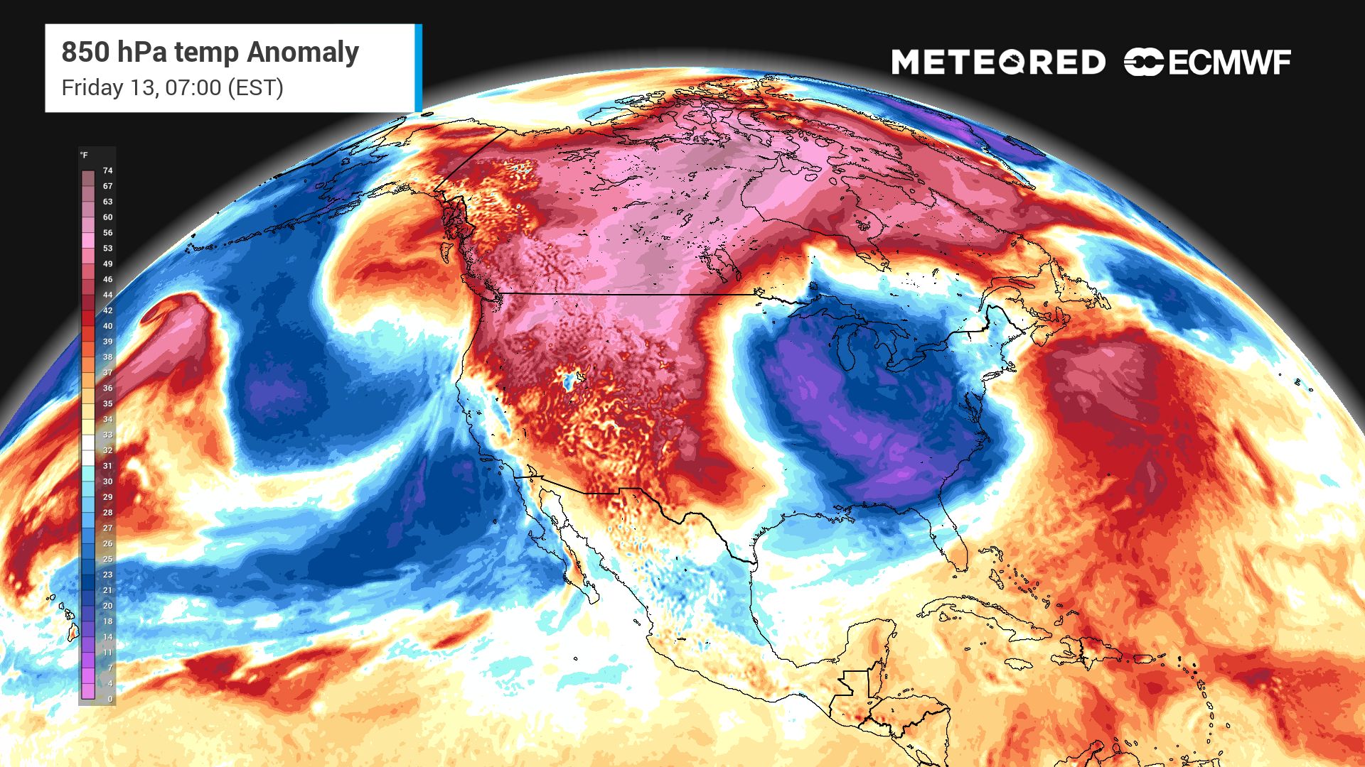
As a strong cold front pushes east, temperatures will drop sharply across the U.S., allowing rain to transition to snow in areas where colder air becomes established. A surge of colder air moving across the central and eastern United States will bring the potential for accumulating snow to parts of the Great Lakes region and the higher elevations of the Appalachians. Snow could accumulate as colder air moves in The first round of snow is expected to develop Wednesday night as colder air moves across the relatively warm waters of the Great Lakes. This temperature contrast will generate lake-effect precipitation, with a mix of rain and snow showers possible downwind of the lakes. The highest accumulations are expected over the higher terrain of Michigan’s Upper Peninsula and near the southern shore of Lake Superior. In those areas persistent lake-effect snow could produce localized accumulating snowfall.
This excerpt comes from the named source. Read the original for the full reporting.
Read the original at Meteored United States