Local
Wild weather in the West will move toward the middle of the country during the third week of November
Meet in Common connects news with real conversations. Use ThinkMatch to arrange a Roundtable and meet people to discuss this story.
Roundtables are designed for groups of four, with a shared subject and room for everyone to speak. Come for discussion, with no dating expectation.
Source: Meteored United States
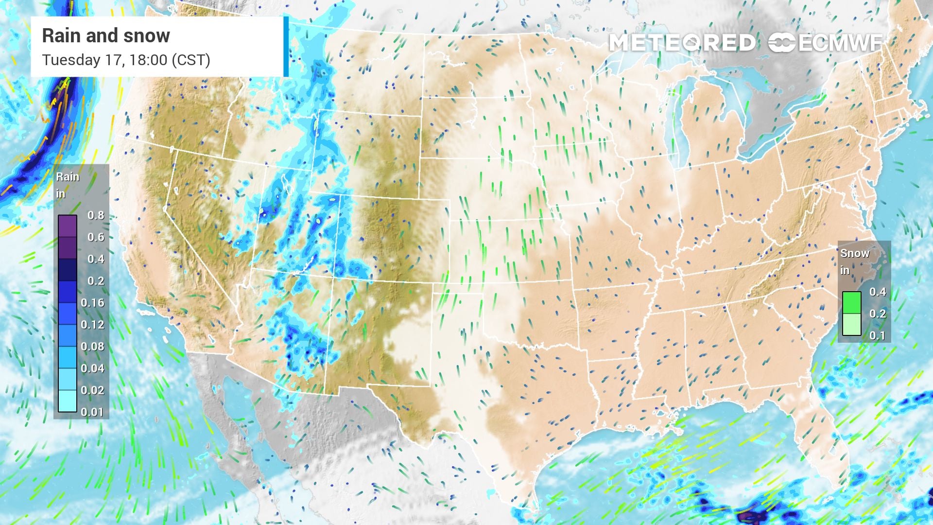
A series of storm systems will wash ashore along the West Coast during the early part of the third week of November. The unsettled pattern will move east as the week progresses as temperatures climb for most of the country. Atmospheric-fueled rounds of rain and mountain snow will pound the Pacific Northwest and portions of California through early Thursday. The Sierra Nevada will start the week with significant snowfall. A winter weather advisory for the region will be in effect Monday through early Tuesday morning. Some spots above 6,000 feet could see another 3 to 7 inches. A system impacting the West on Tuesday will bring significant high-elevation snow to the Great Basin and Rockies. The storm could eventually even bring snow to parts of the High Plains by Wednesday. Right on the heels of this system, another storm will wallop the West Coast by early Wednesday. Moderate to heavy snow should fall from the Cascades south to the Sierra Nevada region.
This excerpt comes from the named source. Read the original for the full reporting.
Read the original at Meteored United States